ALL SEASONS ALL THE TIME
Nature provides the best track for any cyclist! On smooth, paved roads for a leisurely ride, or over challenging terrain to test your mettle, experience spring blooms and fall foliage first-hand. Enjoy Washburn’s Historic Tour with your family, or overcome the steep, winding trails of Mt. Ashwabay and Mt. Valhalla for a sense of accomplishment, or even get around town for a sweet treat, Washburn has a route for all ages and all bodies.
Travel Wisconsin’s page on biking in the Chequamegon-Nicolet National Forest.
For more specific information about biking in and around Washburn click here! Physical maps, routes, and self-guided tour pamphlets can also be picked up at the Chamber for free:
- Washburn Area Chamber
100 W Bayfield Street
Washburn, WI
CLUBS & ASSOCIATIONS
North Coast Cycling Association (NCCA)
(715) 373-2114
Chequamegon Area Mountain Bike Association (CAMBA)
Superior Vistas Annual Bike Tour hosted by the Washburn Area Chamber of Commerce and the NCAA.
WINTER BIKING AKA “FAT TIRE BIKING”
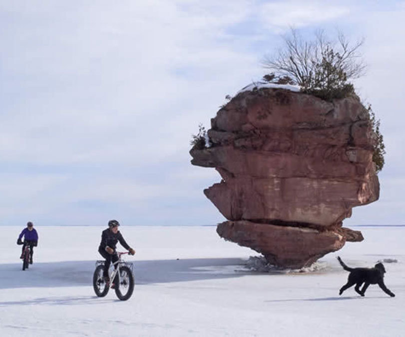
Bike out our front door onto the ice of Chequamegon Bay and explore Washburn’s very own ice caves east of town! Winter offers a new way to adventure for cyclists. Known as “fat tire” biking or winter biking, the wide, low-volume winterized tires will take you anywhere with ease. Strap on your snow tires and hit the snowy trails of the North Woods, the ice of Lake Superior, or the deep, sandy ruts of the Chequamegon-Nicolet National Forest and take in the beauty of the Northland in its winter coat.
Mt. Ashwabay Ski & Recreation area fat tire trail map.
SUPERIOR VISTAS TOUR
Held every year on the fourth Saturday in June, the Lake Superior Vistas Tour promotes the beauty of our Chequamegon Bay and celebrates the community with 9 routes: 7 normal routes, and 2 fat tire routes. Cruise through rolling hills, surrounding forests, and countryside while enjoying an incredible view of Lake Superior you can’t get anywhere else!
The race is fully supported with route maps, rest stops, and support vehicles, and features food and beverage stops along the way. Some routes overlap so you may lengthen or shorten your ride as you wish!
- 13 Mile Loop – beginner-friendly, hilly, with rest stops at miles 5 and 8
- 19 & 34 Mile Loops – one rest stop at Long Lake
- 40 Mile “Out & Back” Loop – 5 fully-stocked rest stops
- 52 & 70 Loops – through Moquah Barrens, then over 20 miles of the smoothest blacktop the Chequamegon-Nicolet National Forest has to offer
- 100 “Century” Mile Loop – overlaps with the 52 & 70 Mile Loops
- Long Lake Fat Tire Loop – this 12.4-mile route is recommended for beginner to intermediate riders. This route is almost entirely on hard packed forest roads, including some minor hills. Some deep sand may occur.
- Mt. Valhalla Fat Tire Loop – this 8.8-mile route is recommended for intermediate to advanced riders. Fat bikes only. No mountain bikes due to occasional deep sand. This challenging route includes steep hills, hard packed and sandy forest roads, and grass-covered trails. Route highlights include vistas from the Fire Tower and from the top of the Sun Bowl trail, a remnant of Ice Age glaciation.

